Highest Point

2440 meters

Sierra El Tigre

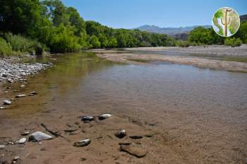
The Sierra El Tigre of northeastern Sonora is a rugged Sky Island mountain range. It covers substantial terrain – its basal area spreads out over 600 square miles. Surrounded by the Rio Bavispe valley on three sides, it is somewhat isolated from neighboring high country, except from the south where it is nearly a peninsular extension from the spine of the Sierra Madre Occidental. The Sierra El Tigre is separated from the Sierra Madre by a pass of rugged hills that rise to around 1,200 to 1,600 meters (INEGI, 1998).

The Vegetation and Flora of the Region of the Rio de Bavispe (Stephen S. White, 1948)

Vegetation and Flora research from 1938 to 1941 in the Rio Bavispe / Sierra El Tigre region. At that time White said that the area "...certainly is one of the least known regions of the North Mexican border" and "has been almost completely neglected by scientists". This is no longer entirely true about northeastern Sonora, but there are still large gaps in knowledge in the region.

From the Introduction:

Trip Report - Sierra El Tigre, Sonora, Mexico

The goal in traveling to the Sierra El Tigre - one of the most extensive of the sky islands - was to complete a basic bio-geographical assessment of the area, listing species of flora and fauna present in the Sierra El Tigre and especially “Fracción Número III Sierra El Tigre” property of Francisco Tarazón, located within the limits of the Ajos-Bavispe Reserve. We also sought to determine the extent of past and present human disturbance and impact as well as the extent of wilderness character in the range.