We used data from eight years of camera trapping at Rancho El Aribabi, a cattle ranch and conservation property in northern Sonora, Mexico, to examine the ecology of the northern-most known breeding population of ocelots (Leopardus pardalis). Ocelots were found mostly in two discrete and disjunct areas: a riverine riparian canyon at just less than 1,000 masl elevation and along arroyos in an oak-mesquite savanna in the Sierra Azul at 1,266–1,406 masl. An ocelot was also detected at a site…
Interest in the new philosophy of ecosystem management led the Forest Service to sponsor a study of past land use in the Lone Mountain/San Rafael Valley Ecosystem Project Area, part of the Sierra Vista Ranger District of Coronado National Forest in southern Arizona. In order to better understand the cumulative impacts on the project area, the agency requested an historical chronology of human occupation of the area, with a focus on natural resource use and an analysis of the impacts of…
The Sierra Madre Occidental (SMO) extends from northeastern Sonora and northwestern Chihuahua south through western Mexico to the Transverse Volcanic Axis in the state of Guanajuato, which forms a montane bridge to the Sierra Madre del Sur to the south and the Sierra Madre Oriental to the east. All of these mountain ranges are volcanic in origin and are part of the American Cordillera that shapes the western backbone of North, Central, and South America, and Antarctica (Dickinson 2004). The…
Renewed botanical interest in the Sonoran islands of the Gulf of California (Islas Tiburón, San Esteban, San Pedro Nolasco, Dátil, and Alcatraz) as part of our project, “Botanical Diversity of Isla Tiburón and Satellite Islands, Gulf of California,” has resulted in 61 new ad- ditions and distributional clarifications to the floras of these islands. These new records represent increases of 16% for Tiburón, 4% for San Esteban, 3.5% for San Pedro Nolasco, 3% for Dátil, and 12% for…
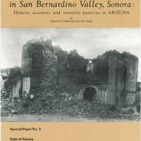
On May 3, 1887, a major earthquake shook much of the southwest United States and Mexico, an area of nearly two million square kilometers. This seismic event, with an estimated magnitude of 7.2 (DuBois and Sbar, in press), caused 51 deaths in northern Sonora, and major destruction of property in southeast Arizona, as well as adjacent portions of Mexico. Moderate damage also occurred in New Mexico.
The 1887 epicenter was south of the Arizona-Mexico border in the San Bernardino Valley…
More than one third of Forrest Shreve's (1951 ) Sonoran Desert lies within the boundaries of Sonora, the second largest state in Mexico. Five of the seven major vegetational subdivisions of the Sonoran Desert are found within Sonora as well, more than in any other state. It is safe to say that the specific biological diversity found in the Sonoran portion of the Sonoran Desert is greater than in any other desert in the world.
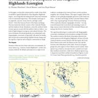
In this paper, we describe and present the results of our effort to establish a spatial delineation of the Mogollon Highlands region—an ecologically fascinating North American transition zone of continental importance. is dramatic landscape of escarpments, canyons, mesas, deserts, and high conifer forests—where the Sonoran Desert of the Basin and Range Province meets the redrock country of the Colorado Plateau and the Southern Rocky Mountains, where the northern limits of some species…

